Fanno Creek Trail Connections Project
Fanno Creek Trail Connections Project Update
CURRENT STATUS: DELAYED
While we had hoped construction of the Fanno Creek Trail Connections Project would take place in 2021-2022, unfortunately due to complexity it is now scheduled to start in late 2023 or in early 2024.
Reasons for delay included:
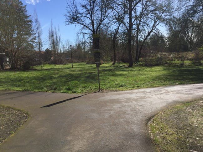
- Project Updates – The specific federal grant program required that the trail width be increased from 10-feet to 12-feet.
- Environmental Permitting – Our partnership with Clean Water Services for streamside management is unique and required additional effort to meet federal grant requirements.
- Increased Construction Cost – Cost increases resulting from unforeseen circumstances like the above require additional process and approval from project partners, which causes additional delay. General market inflation due to COVID-19 is also expected to increase construction costs, as supply chain, labor market, and other issues arise.
- Read the entire project update (7/1/22)
Fanno Creek Trail Connections Project Update
CURRENT STATUS: DELAYED
While we had hoped construction of the Fanno Creek Trail Connections Project would take place in 2021-2022, unfortunately due to complexity it is now scheduled to start in late 2023 or in early 2024.
Reasons for delay included:
- Project Updates – The specific federal grant program required that the trail width be increased from 10-feet to 12-feet.
- Environmental Permitting – Our partnership with Clean Water Services for streamside management is unique and required additional effort to meet federal grant requirements.
- Increased Construction Cost – Cost increases resulting from unforeseen circumstances like the above require additional process and approval from project partners, which causes additional delay. General market inflation due to COVID-19 is also expected to increase construction costs, as supply chain, labor market, and other issues arise.
- Read the entire project update (7/1/22)
3. Submit your questions and comments:
-
Share As someone who thrives off nature and being active, I just want to say how much it means to me and my wife to have a multi-use path that connects so many things right outside our door (downtown Tigard). Do you need any volunteers to help with the project or construction? I'd love to contribute my time if I can. on Facebook Share As someone who thrives off nature and being active, I just want to say how much it means to me and my wife to have a multi-use path that connects so many things right outside our door (downtown Tigard). Do you need any volunteers to help with the project or construction? I'd love to contribute my time if I can. on X (formerly Twitter) Share As someone who thrives off nature and being active, I just want to say how much it means to me and my wife to have a multi-use path that connects so many things right outside our door (downtown Tigard). Do you need any volunteers to help with the project or construction? I'd love to contribute my time if I can. on Linkedin Email As someone who thrives off nature and being active, I just want to say how much it means to me and my wife to have a multi-use path that connects so many things right outside our door (downtown Tigard). Do you need any volunteers to help with the project or construction? I'd love to contribute my time if I can. link
As someone who thrives off nature and being active, I just want to say how much it means to me and my wife to have a multi-use path that connects so many things right outside our door (downtown Tigard). Do you need any volunteers to help with the project or construction? I'd love to contribute my time if I can.
Erin Saver asked over 6 years agoThank you for your generous offer. At this time we don’t need help with construction. However, there is always a need for trash picking along the creek. Feel free to contact Chad Morrow if you would like to volunteer to help keep the trail and creek trash free. chad@tigard-or.gov.
-
Share Where the trail must align next to commercial or industrial development, please plant a visual screen (perhaps of arborvita) to soften and hide the transition. Also along the trail replacement north of City Hall. on Facebook Share Where the trail must align next to commercial or industrial development, please plant a visual screen (perhaps of arborvita) to soften and hide the transition. Also along the trail replacement north of City Hall. on X (formerly Twitter) Share Where the trail must align next to commercial or industrial development, please plant a visual screen (perhaps of arborvita) to soften and hide the transition. Also along the trail replacement north of City Hall. on Linkedin Email Where the trail must align next to commercial or industrial development, please plant a visual screen (perhaps of arborvita) to soften and hide the transition. Also along the trail replacement north of City Hall. link
Where the trail must align next to commercial or industrial development, please plant a visual screen (perhaps of arborvita) to soften and hide the transition. Also along the trail replacement north of City Hall.
cd asked over 6 years agoWill do as much as possible to screen industrial developments. There are more opportunities to do this between Woodard and Grant. Behind City Hall ,along the Frontier lot, there will be more challenges as the creek is tight to the trail and there is little room to accommodate planting on the industrial side of the trail.
-
Share My humble opinion - Some suggestions: Woodyard to Grand. Most bang for the cost. Library section. Use existing bridge by Hall Blvd to access NE side of Fanno Creek and trail to Boneta Rd. Avoid shortcut and another bridge. 85th to Tualatin River. Don't bother, there are good trails in existence now. Don't need a shortcut across the old farm. Thank you, Jack Arendt on Facebook Share My humble opinion - Some suggestions: Woodyard to Grand. Most bang for the cost. Library section. Use existing bridge by Hall Blvd to access NE side of Fanno Creek and trail to Boneta Rd. Avoid shortcut and another bridge. 85th to Tualatin River. Don't bother, there are good trails in existence now. Don't need a shortcut across the old farm. Thank you, Jack Arendt on X (formerly Twitter) Share My humble opinion - Some suggestions: Woodyard to Grand. Most bang for the cost. Library section. Use existing bridge by Hall Blvd to access NE side of Fanno Creek and trail to Boneta Rd. Avoid shortcut and another bridge. 85th to Tualatin River. Don't bother, there are good trails in existence now. Don't need a shortcut across the old farm. Thank you, Jack Arendt on Linkedin Email My humble opinion - Some suggestions: Woodyard to Grand. Most bang for the cost. Library section. Use existing bridge by Hall Blvd to access NE side of Fanno Creek and trail to Boneta Rd. Avoid shortcut and another bridge. 85th to Tualatin River. Don't bother, there are good trails in existence now. Don't need a shortcut across the old farm. Thank you, Jack Arendt link
My humble opinion - Some suggestions: Woodyard to Grand. Most bang for the cost. Library section. Use existing bridge by Hall Blvd to access NE side of Fanno Creek and trail to Boneta Rd. Avoid shortcut and another bridge. 85th to Tualatin River. Don't bother, there are good trails in existence now. Don't need a shortcut across the old farm. Thank you, Jack Arendt
Jack asked over 6 years agoThank you for your comments. Here is a little more detail behind siting decisions for the trail: Woodard to Grant Avenue segment has been the most popular. Library Section: We did evaluate the route your describe, however there were significant impacts to wetlands and streams and Red Rock Creek would have to be crossed in order for this route to work. Also that route would require significantly more boardwalk and is much lower in elevation so the trail would often be flooded. 85th to Tualatin River: This segment is important to support non-motorized commuter traffic on the trail, there are many conflicts between park users and commuters as the trail winds through Cook Park’s Butterfly Garden, play area, and large groups moving to and from field sport events. Much of the funding that is supporting construction of the trail is federal transportation dollars. So the decision to site through the old farm was driven by the need for a more direct non-motorized north-south route through Washington County, paralleling I-5 and 217.
-
Share When will the project be constructed? on Facebook Share When will the project be constructed? on X (formerly Twitter) Share When will the project be constructed? on Linkedin Email When will the project be constructed? link
When will the project be constructed?
marissa asked over 6 years agoThe project is scheduled to go to bid in December of 2020. Construction is expected to end in 2022.
-
Share Why does construction take this long? on Facebook Share Why does construction take this long? on X (formerly Twitter) Share Why does construction take this long? on Linkedin Email Why does construction take this long? link
Why does construction take this long?
marissa asked over 6 years agoThe contractor will need time to have bridges and boardwalks fabricated. It is also expected that two dry seasons will be required to complete trail construction. This is to allow wet areas along the new trail alignment to dry out for equipment access.
-
Share Will the new trail segments flood like some areas of the existing trail? on Facebook Share Will the new trail segments flood like some areas of the existing trail? on X (formerly Twitter) Share Will the new trail segments flood like some areas of the existing trail? on Linkedin Email Will the new trail segments flood like some areas of the existing trail? link
Will the new trail segments flood like some areas of the existing trail?
marissa asked over 6 years agoIn a large storm event, the new trail segments may experience flooding. This is not expected to be frequent. Under normal rain years approximately two times per year. The new segments are expected to drain quickly.
Trails are the only allowed use in the floodplain and as such will be flooded from time to time. The floodplain protects Tigard residents from severe flooding of homes, businesses, and streets. Some days the floodplain will be working to protect our citizens and their homes. But most of the time the floodplain will provide an amazing nature experience for trail users.
-
Share How much will this project cost? on Facebook Share How much will this project cost? on X (formerly Twitter) Share How much will this project cost? on Linkedin Email How much will this project cost? link
How much will this project cost?
marissa asked over 6 years agoThe total project cost is 7.8 million. Over half of this cost is funded through a Federal Highway Administration Air Quality Grant administered by Oregon Department of Transportation and Metro.
-
Share Does this project complete the Fanno Creek Trail in Tigard? on Facebook Share Does this project complete the Fanno Creek Trail in Tigard? on X (formerly Twitter) Share Does this project complete the Fanno Creek Trail in Tigard? on Linkedin Email Does this project complete the Fanno Creek Trail in Tigard? link
Does this project complete the Fanno Creek Trail in Tigard?
marissa asked over 6 years agoNo, one more segment remains and is located between Bonita Road south to connect at 85th Avenue or to the City of Durham. There is currently a siting study being completed for this segment. The study will identify a preferred alignment and will include construction cost estimates that will allow the City to pursue grant funding for construction.
-
Share Putting athletic fields in the natural area behind the library is a bad idea. There is no road access on Facebook Share Putting athletic fields in the natural area behind the library is a bad idea. There is no road access on X (formerly Twitter) Share Putting athletic fields in the natural area behind the library is a bad idea. There is no road access on Linkedin Email Putting athletic fields in the natural area behind the library is a bad idea. There is no road access link
Putting athletic fields in the natural area behind the library is a bad idea. There is no road access
Brian asked over 6 years agoThank you for this suggestion. Tigard is currently updating the parks master plan that will guide future park development. I will pass this comment onto the consultant and our park manager. Please watch the Tigard engagement page for upcoming opportunities to provide input on that plan.
-
Share Are there hard Construction start dates? on Facebook Share Are there hard Construction start dates? on X (formerly Twitter) Share Are there hard Construction start dates? on Linkedin Email Are there hard Construction start dates? link
Are there hard Construction start dates?
Campagnolo4me asked over 6 years agoNot exact dates. The construction contract will be administered by the Oregon Department of Transportation (ODOT). ODOT will control the bid process and award of the contract. The project will be bid in December of 2020. ODOT will then go through their process to award the contract. Time frames can vary depending on ODOT’s workload and the number of contracts being bid at the same time as this contract.
-
Project Manager
Phone 503-718-2788 Email carla@tigard-or.gov
-
 Click here to play video
Fanno Creek Trail Connections Project
Click here to play video
Fanno Creek Trail Connections Project
- There is a cost overrun on the project, identified by staff and shared with City Council
- The overrun is the result of a prolonged grant process during a time of rising construction costs
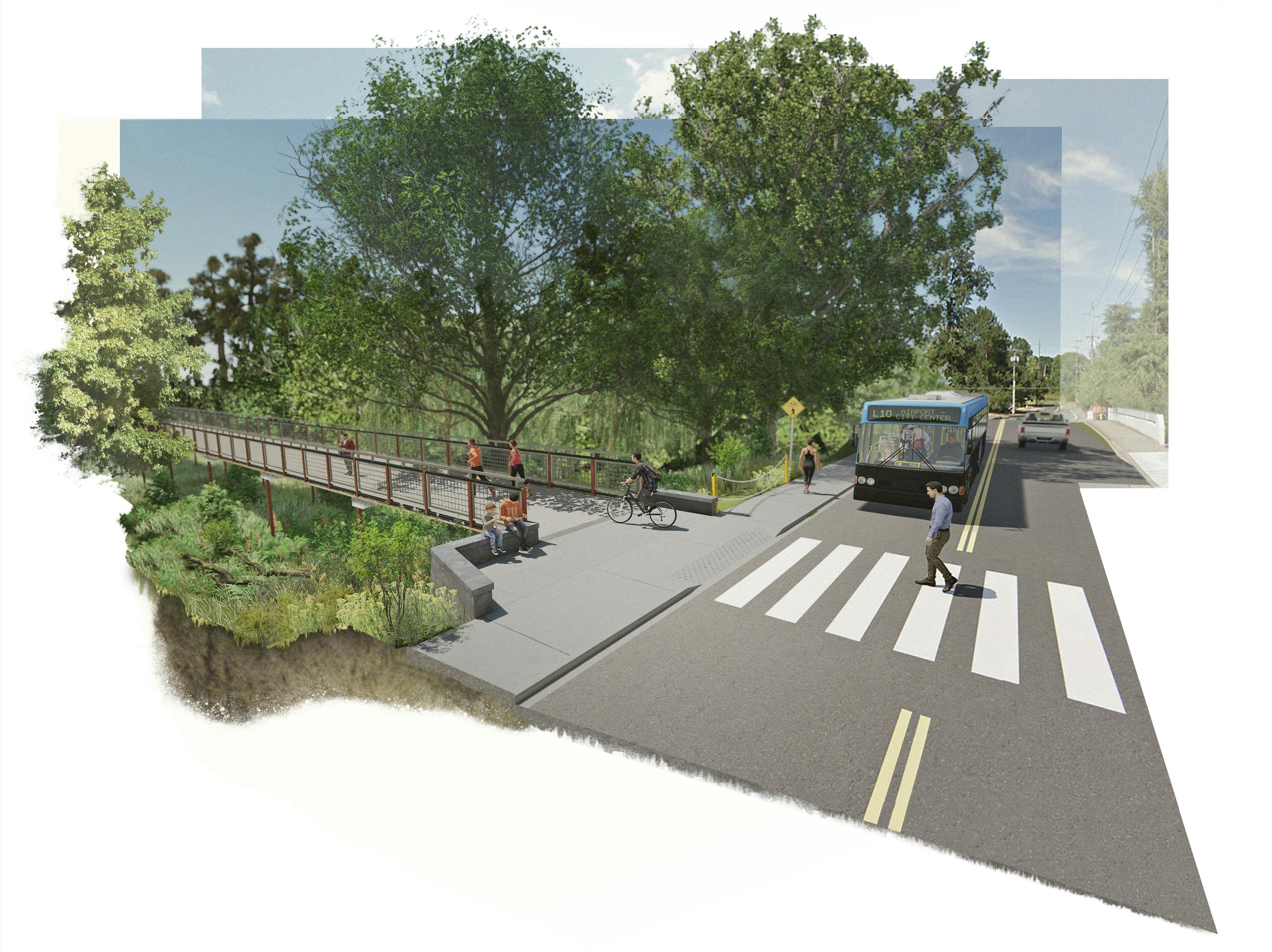
- There was also a demand by FHWA that the trail be widened from 8 to 12 feet and the bridges from 10 to 14 feet.
- Ending fund balances for fiscal year 2019-20 were analyzed and found to have enough dollars to cover the overrun
- Staff is recommending utilizing this funding to complete the project.
- City Council was briefed and supportive of completing the project.
- The city budget will be adopted by Council in June, at which time the project is expected to be fully funded.