
Tiedeman Avenue Multimodal Study
Share Tiedeman Avenue Multimodal Study on Facebook
Share Tiedeman Avenue Multimodal Study on Twitter
Share Tiedeman Avenue Multimodal Study on Linkedin
Email Tiedeman Avenue Multimodal Study link
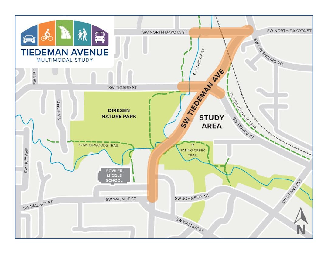
The Tiedeman Avenue Multimodal Study aims to improve the safety, walkability, and connectivity on Tiedeman Avenue from Greenburg Road to Walnut Street, and the surrounding area.
We want to know what transportation improvements would help get you where you need to go, whether walking, bicycling, riding transit or driving.
This study will be guided by community input and will be guided by Tigard’s Strategic Plan and Complete Streets policy, each aimed at supporting equitable access for road users of all ages and abilities. We want to hear from you!
Page last updated: 11 Jul 2025, 10:13 AM
